Module 6: Georeferencing, Editing, & 3D
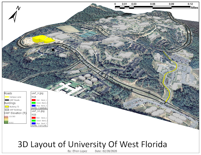
This weeks lab was pretty awesome, I learned how to make a 3-D map. Overall this week went smooth, I did not run into any major problems. Most of the work done was a test of what I have learned in past labs. I thought it was neat that I clipped building 72 and Campus lane from their original listings. That way I am able to individually change the symbology. Using the control points was also neat, this reminds me of Photoshop. although nothing ever lined up for me perfectly, but I figured that is normal since the picture gets distorted as more control points and higher order transformation is used.


Comments
Post a Comment